

USDA-FS Geospatial Fellow: Interactive Application and Content Publishing
To submit your application, scroll to the bottom of this opportunity and click APPLY.
A complete application consists of:
- An application
- Transcript(s) – For this opportunity, an unofficial transcript or copy of the student academic records printed by the applicant or by academic advisors from internal institution systems may be submitted. Click here for detailed information about acceptable transcripts.
- A current resume/CV, including academic history, employment history, relevant experiences, and publication list
- Two educational or professional recommendations.
All documents must be in English or include an official English translation.
Connect with ORISE...on the GO! Download the new ORISE GO mobile app in the Apple App Store or Google Play Store to help you stay engaged, connected, and informed during your ORISE experience and beyond!
*Applications will be reviewed on a rolling-basis. June 8, 2026 update: In order to review on a rolling-basis the unexpectedly high volume of applicants, this posting has closed early. Our system will still allow recommendations to be submitted for those applications already entered into the portal.
USDA Forest Service Office/Lab and Location: A fellowship opportunity is available with the US Department of Agriculture (USDA) Forest Service (FS) within the Forest Service Northern Research Station (NRS). This opportunity is remote, but the participant may need to visit an on-site location in the Forest Service office within the footprints of Regions 8 and 9 (which includes the following states: Alabama, Arkansas, Connecticut, District of Columbia, Delaware, Florida, Georgia, Iowa, Illinois, Indiana, Kentucky, Louisiana, Massachusetts, Maryland, Maine, Michigan, Minnesota, Missouri, Mississippi, North Carolina, New Hampshire, New Jersey, New York, Ohio, Oklahoma, Pennsylvania, Rhode Island, South Carolina, Tennessee, Texas, Virginia, Vermont, Wisconsin, and West Virginia)
At the heart of the USDA Forest Service's mission is their purpose. Everything they do is intended to help sustain forests and grasslands for present and future generations. Why? Because their stewardship work supports nature in sustaining life. This is the purpose that drives the agency’s mission and motivates their work across the agency. It’s been there from the agency’s very beginning, and it still drives them. To advance the mission and serve their purpose, the USDA Forest Service balances the short and long-term needs of people and nature by: working in collaboration with communities and our partners; providing access to resources and experiences that promote economic, ecological, and social vitality; connecting people to the land and one another; and delivering world-class science, technology and land management.
Research Project: The opportunity will collaborate with a small group of researchers in developing ArcGIS Online content and an interactive application to serve a wide users by providing access to tree species range maps. This content is part of an on-going effort to update the Silvics of North America through an international collaboration. Habitat suitability models provide useful information to forest managers, resource managers, landowners, and a wide range of interested users. The updated Silvics of North America Program (USNAP) Distribution and Environmental Associations Team has produced species distribution models for 326 tree species occurring across North America under current and projected future scenarios. Additionally, occurrence maps have been developed from various sources to indicate recent and known locations of tree species. Development of ArcGIS Online interactive applications to allow users to explore tree species ranges helps with interpretation of regional landscapes and forest management planning.
Learning Objectives: Under the guidance of a mentor, the participant will have the opportunity to:
- Learn about the implementation of content within the developed AGOL products.
- Enhance collaborative skills by participating as a fellow on a multidisciplinary team of research scientists and natural resource specialists from federal agencies and universities.
- Strengthen their research, analysis, and writing skills in spatial analysis, science synthesis, and assessments of forest assets and conditions.
- Enhance their communication skills through participating in team meetings and project documentation.
Mentor: The mentors for this opportunity are Matthew Peters (matthew.p.peters@usda.gov) and Maria Janowiak (maria.janowiak@usda.gov). If you have questions about the nature of the research, please contact the mentors.
Anticipated Appointment Start Date: June 2026. Start date is flexible and will depend on a variety of factors.
Appointment Length: The appointment will initially be for seven months but may be extended upon recommendation of USDA Forest Service and is contingent on the availability of funds.
Level of Participation: The appointment is full time.
Participant Stipend: The participant will receive a monthly stipend commensurate with educational level and experience. The anticipated stipend range is $4,166.67 - $6,241.88 monthly.
Citizenship Requirements: This opportunity is available to U.S. citizens only.
ORISE Information: This program, administered by ORAU through its contract with the U.S. Department of Energy (DOE) to manage the Oak Ridge Institute for Science and Education (ORISE), was established through an interagency agreement between DOE and USDA Forest Service. Participants do not become employees of USDA, USDA Forest Service, DOE or the program administrator, and there are no employment-related benefits. Proof of health insurance is required for participation in this program. Health insurance can be obtained through ORISE.
Questions: Please visit our Program Website. After reading, if you have additional questions about the application process please email ORISE.USFS.NRS@orau.org and include the reference code for this opportunity.
The qualified candidate should have received a bachelor's or master's degree in one of the relevant fields (Geography, Ecology, Environmental Science, Earth System Science, or related field). Degree must have been received within the past two years and six months.
Preferred Skills:
- Oral and written communication skills in English.
- Experience in ArcGIS Online (AGOL)
- Have a familiarity with R or Python programming languages.
- Experience with geographic information systems (GIS), data entry and database design, metadata and documentation.
- Experience with AGOL Experience Builder, Dashboards, and/or Instant Apps
- Citizenship: U.S. Citizen Only
- Degree: Bachelor's Degree or Master's Degree received within the last 31 month(s).
- Discipline(s):

 ORISE GO
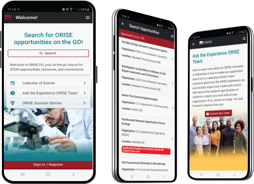
The ORISE GO mobile app helps you stay engaged, connected and informed during your ORISE experience – from application, to offer, through your appointment and even as an ORISE alum!