Environmental Security Risk Forecasting
Create and release your Profile on Zintellect – Postdoctoral applicants must create an account and complete a profile in the on-line application system. Please note: your resume/CV may not exceed 2 pages.
Complete your application – Enter the rest of the information required for the IC Postdoc Program Research Opportunity. The application itself contains detailed instructions for each one of these components: availability, citizenship, transcripts, dissertation abstract, publication and presentation plan, and information about your Research Advisor co-applicant.
Additional information about the IC Postdoctoral Research Fellowship Program is available on the program website located at: https://orise.orau.gov/icpostdoc/index.html.
If you have questions, send an email to ICPostdoc@orau.org. Please include the reference code for this opportunity in your email.
Research Topic Description, including Problem Statement:
Environmental security focuses on the nexus between environmental/climate issues and national security. Understanding and predicting the effects and implications of environmental/climate events is critical to the safety of U.S. personnel and infrastructure. Research should begin with a forensic analysis of remote sensing data from natural disasters, correlated with climate change, which damaged critical U.S. infrastructure to identify potential predictive variables. Using identified predictive variables, develop a model that forecasts the likelihood of the selected natural disasters and their potential impacts to critical infrastructure. Ideally, forecast models should produce possible mitigation strategies.
Example Approaches:
- One potential approach is to restrict initial study to wildfires. Currently, fire intelligence analysts compile climate and drought forecasts, regional fuel conditions, and satellite and mapping imagery into short-term and seasonal forecasts for broad regions [1]. However, these existing forecasting methods are unable to make fine-grained distinctions in at-risk areas based on small scale variations in land use, land use change, vegetation, and; moreover, proximity to critical infrastructure.
- In recent years, both the volume and resolution of commercial and publicly available satellite imagery relevant to wildfire forecasting have massively increased. Together with recent improvements in machine learning, this imagery may be used to produce high resolution geospatial intelligence (GEOINT) products relevant to wildfire conditions; for example, land use change, soil moisture, and normalized difference vegetation index[2,3]. Alternative phenomenologies such as synthetic aperture radar and lidar may be applied to monitor conditions and changes in forest health. Additionally, new applications of machine learning have produced much more robust risk assessment modeling in a variety of fields, including fire risk [4].
Relevance to the Intelligence Community:
The National Geospatial-Intelligence Agency (NGA) provides GEOINT to support national policy makers and other federal and local agencies on matters of environmental security such as humanitarian and disaster relief efforts. Much of this GEOINT provides tactical intelligence, such as by complementing the picture on the ground with near-real-time GEOINT to build a comprehensive awareness of the operating environment (e.g., Firefly [5]). Due to the increasing incidence and severity of natural disasters correlated with climate change [6], the Intelligence Community — and NGA specifically — requires the capability to forecast such events, particularly in areas where critical infrastructure is present, which would allow decision makers time to implement mitigation strategies beforehand.
References:
- “Fire Forecasting”, USDA Science and Technology, Fire Science, www.fs.usda.gov/science-technology/fire/forecasting. Accessed Sept 24, 2021
- Khan S., Alarabi L., and Basalamah S., “Deep Hybrid Network for Land Cover Semantic Segmentation in High-Spatial Resolution Satellite Images”, Information 2021, 12, 230. doi.org/10.3390/info12060230.
- Babaeian, E. et al. “A New Optical Remote Sensing Technique for High-Resolution Mapping of Soil Moisture”, Front. Big Data, 05 November 2019, doi.org/10.3389/fdata.2019.00037.
- Lee, J., Lin, Y., and Madaio, M. (2018). A Longitudinal Evaluation of a Deployed Fire Risk Model. Presented at the AI for Social Good Workshop at the Neural Information Processing System Conference. (NeurIPS 2018).
- Lopez, T., “DOD Extends 'Firefly,' Related 'FireGuard' Support to Extinguish Wildfires”, U.S. Department of Defense News, https://www.defense.gov/News/News-Stories/Article/Article/2768197/dod-extends-firefly-related-fireguard-support-to-extinguish-wildfires/. Accessed Sept 24, 2021.
- “Climate and Land Use Change”, USGS FAQ, www.usgs.gov/faq/climate-and-land-use-change. Accessed Sept 24, 2021.
Key Words: Environmental Security, Climate, Fire, Natural Disasters, Forecasting, Remote Sensing, Computer Vision, Machine Learning, Deep Learning
Postdoc Eligibility
- U.S. citizens only
- Ph.D. in a relevant field must be completed before beginning the appointment and within five years of the application deadline
- Proposal must be associated with an accredited U.S. university, college, or U.S. government laboratory
- Eligible candidates may only receive one award from the IC Postdoctoral Research Fellowship Program
Research Advisor Eligibility
- Must be an employee of an accredited U.S. university, college or U.S. government laboratory
- Are not required to be U.S. citizens
- Citizenship: U.S. Citizen Only
- Degree: Doctoral Degree.
-
Discipline(s):
- Chemistry and Materials Sciences (12 )
- Communications and Graphics Design (2 )
- Computer, Information, and Data Sciences (16 )
- Earth and Geosciences (21 )
- Engineering (27 )
- Environmental and Marine Sciences (14 )
- Life Health and Medical Sciences (45 )
- Mathematics and Statistics (10 )
- Other Non-Science & Engineering (2 )
- Physics (16 )
- Science & Engineering-related (1 )
- Social and Behavioral Sciences (27 )

 ORISE GO

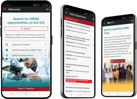
The ORISE GO mobile app helps you stay engaged, connected and informed during your ORISE experience – from application, to offer, through your appointment and even as an ORISE alum!


