Field Data Collection Coordinator
Components of the online application are as follows:
- Profile Information
- Educational and Employment History
- Essay Questions (goals, experiences, and skills relevant to the opportunity)
- Resume (PDF)
- Transcripts/Academic Records - For this opportunity, an unofficial transcript or copy of the student academic records printed by the applicant or an academic advisor from an internal institution system may be submitted.
- One Recommendation
Submitted documents must have all social security numbers, student identification numbers, and/or dates of birth removed (blanked out, blackened out, made illegible, etc.) prior to uploading into the application system.
If you have questions, send an email to orisedod@orise.orau.gov. Please list the reference code of this opportunity in the subject line of the email.
All documents must be in English or include an official English translation.
The Defense POW/MIA Accounting Agency (DPAA) is responsible for finding and recovering missing US Service Members from our Nation's past conflicts. DPAA is a Department of Defense (DoD) joint military organization comprised of military service members, DoD civilians, and contractors, with offices in Hawaii, Washington DC, and Omaha, NE.
DPAA is offering a learning opportunity to support their global search and recovery efforts. The research will be based on the locations and coordinates derived from the analysis of historic documents, current and historic imagery, leads developed through investigations, and previous search and recovery efforts. As a DPAA participant, you will learn all that is needed to maximize the technological capabilities of the systems through research and a hands-on experience. This opportunity will offer experiential learning and exploration in any number of technological areas including:
- Programing automated processes using scripts
- Customizing user interfaces with coding and/or configuration
- Cyber security configurations.
The nature of the Geographic Information System (GIS) industry requires the need to have a large research and educational component in order to be successful. This opportunity will require the individual to interact with users from many different backgrounds and disciplines, including both civilian and military, and from historians to anthropologists. The DPAA GIS brings all these disparate data sources together into a Common Operating Picture (COP) where analysts, historians, archaeologists and anthropologists can visualize and analyze the spatial data in easy-to-use applications. Under the guidance of a mentor, the participant will take part in implementing a Field Data Collection program using Trimble, TopCon, and Leica systems so DPAA teams can collect the pertinent geospatial data when investigating a case or excavating a site.
The program will include:
- Maintaining the hardware inventory
- Configuring data collection devices for teams with the relevant data and schema
- Ensuring data is transferred from data collection devices to the GIS
- Performing QA/QC on the data
- Creating map templates to display the data.
This opportunity will be based in the Hawaii office on Joint Base Pearl Harbor-Hickam (JBPHH).
Appointment Length
This appointment is a twelve month research appointment, with the possibility to be renewed for additional research periods. Appointments may be extended depending on funding availability, project assignment, program rules, and availability of the participant.
Participant Benefits
Participants will receive a stipend to be determined by DPAA. Stipends are typically based on the participant’s academic standing, discipline, experience, and research facility location. Other benefits may include the following:
- Health Insurance Supplement. Participants are eligible to purchase health insurance through ORISE.
- Relocation Allowance
- Training and Travel Allowance
Nature of Appointment
The participant will not enter into an employee/employer relationship with ORISE, ORAU, DOD, or any other office or agency. Instead, the participant will be affiliated with ORISE for the administration of the appointment through the ORISE appointment letter and Terms of Appointment.
The individual should have a minimum of a bachelor's degree in Geography with focus on GIS, Archaeology, or related discipline.
This opportunity requires knowledge of using GNSS devices for field data collection and creating maps that accurately represent the data collected with an emphasis on archaeological field activities.
Experience working in a military environment is preferred.
- Citizenship: U.S. Citizen Only
- Degree: Bachelor's Degree, Master's Degree, or Doctoral Degree received within the last 60 months or currently pursuing.
- Discipline(s):

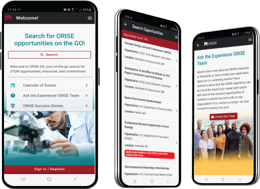
 ORISE GO

The ORISE GO mobile app helps you stay engaged, connected and informed during your ORISE experience – from application, to offer, through your appointment and even as an ORISE alum!


